Click on any image to see an enlargement.

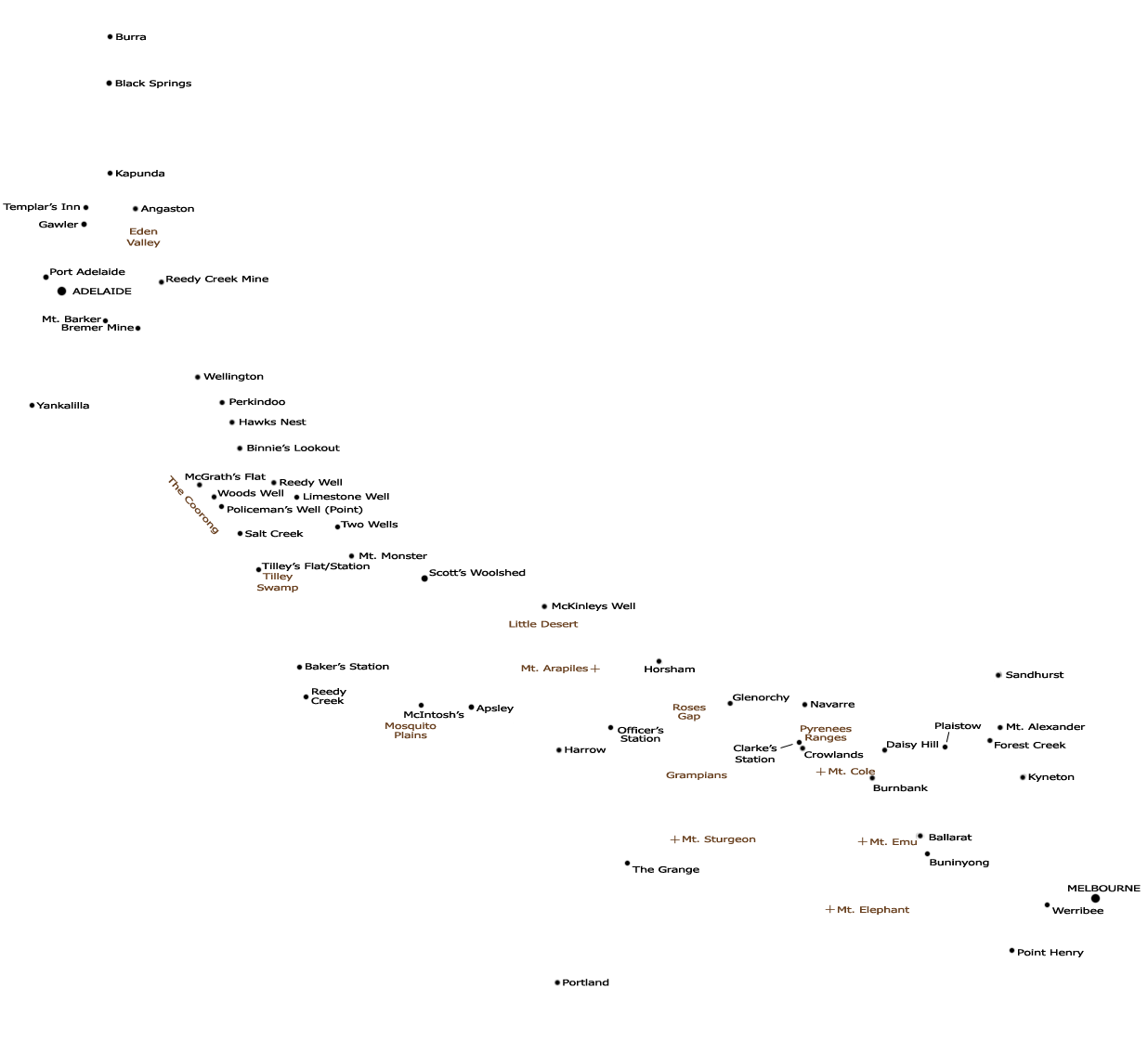
In the late 1840s and early 1850s, Burra developed as a significant copper mining area which attracted many Cornish miners and their families. News of gold discoveries in NSW and Victoria in 1851 saw many leave for the goldfields.
Wellington was the main crossing point over the Murray River. As an example of usage, in February 1852 the Wellington punt carried some 1,234 passengers, 1,266 horses and bullocks and 164 carriages.
In February 1852 Malcolm Leworthy and four others crossed the mouth of the Murray River in a whale boat belonging to a local fisherman. A reference to a pontoon here has not be substantiated.
The mail service between Adelaide and Mt. Gambier was established in September 1846. The route was through Wellington, via The Coorong and south-east to Mt. Gambier.
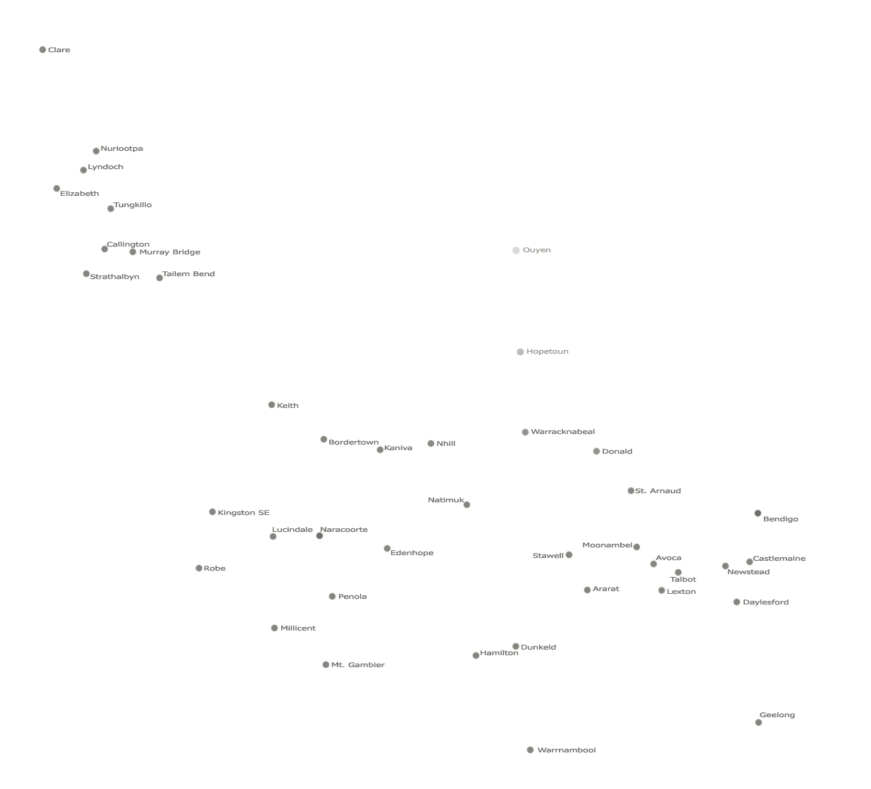
William McIntosh settled here in the mid-1840s and established a hotel, store and later a Post Office, being the beginnings of the town of Naracoorte.
Glenorchy, on the southern end of the Wimmera plain, and a river crossing point for bullock teams was the site of the Four Post Inn established in 1847. Innkeeper Gleeson had a blacksmith's forge here. Glenorchy was surveyed in 1850.
Burnbank was the intersection of routes from Geelong and Melbourne to the northwest, especially for access to the Wimmera. It grew as a service centre for surrounding settlers, and later became known as Lexton.
Ham's Squatting Map of 1851 indicates a surveyed road between Mt. Gambier, Hamilton and beyond along the route of today's Glenelg Highway. Surveyed roads are also shown between Mt. Gambier and Portland, and Portland and Hamilton.
Discovered in 1842, Kapunda was the first copper mining town in Australia, and one of the first 'Copper Roads' was established between here and Port Adelaide.
The route between Kapunda and Wellington described by Thomas Ninnes passed through Angaston, the Reedy Creek Mine (worked 1847-51) and on to the sandy banks of the Murray River.
Apsley, the site of the Border Inn, was originally a postal town serving surrounding settlements, and was at the centre of several inter-regional routes. It was surveyed and named in 1851.
The earliest location known as Daisy Hill (or Daisy Hill Flat) was near Thomas Chapman's shepherds hut on the Glen Mona run where he is reported to have found gold in 1848. Several places in the area were known as Daisy Hill, and Amherst itself was first known by that name. Today, Daisy Hill is in yet another location south of Maryborough.
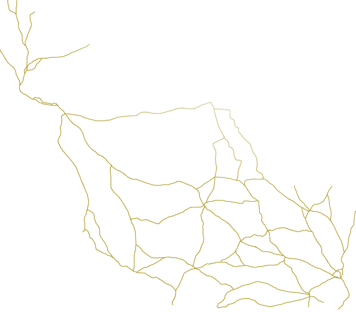
One account has been located of a group using this 'northern' route in Dec 1851, in which they experienced great difficulties due to lack of water. Survey work and well-digging along this route began in late Jan 1852 in preparation for the SA Gold Escort.
The growth of copper mining at Burra from the mid-1840s led to the creation of several 'Copper Roads' linking Burra with Port Adelaide and Port Wakefield. Three roads converged at Black Springs where a permanent spring provided good water.
Settlement in the area began in the 1840s close to a place to cross the Wimmera river with wagons. From January 1851, Horsham, though still a fledgling township, was the centre of a Police district.
The first public announcement of gold discoveries at Bendigo Creek were made in mid-December 1851, and diggers were already arriving in considerable numbers.
News of discoveries at Forest Creek / Mt Alexander (now Castlemaine) began to circulate in October 1851. Reports were soon confirmed by those who were initially successful, and the Victorian 'gold rush' began.
The large swamp area at the southern end of the Coorong, known as Tilley's Swamp or Tilley's Flat, features in many accounts as being difficult to negotiate. Drainage works began in the 1860s to increase the available land for farming and grazing.